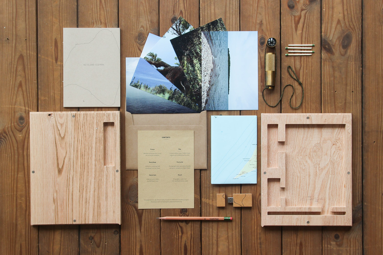
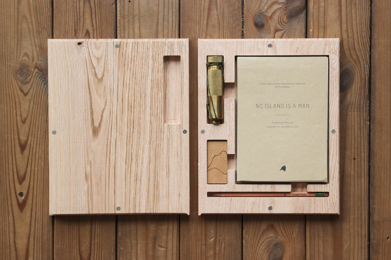
The No Island is a Man artifact kit from Andrew Ranville and the DeVos Art Museum. A limited-edition of only 60, proceeds will benefit the Rabbit Island Residency program, the Keweenaw Land Trust and the Superior Watershed Partnership.
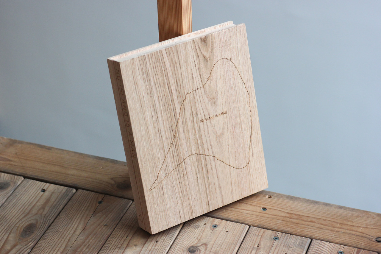
The kit is two CNC-machined and laser-engraved pieces of red oak sourced from the Keweenaw Penninsula held together by powerful magnets. Contained within is an infosheet, the exhibition catalogue and postcard set, a signed Rabbit Island Quadrangle print, an eco USB stick containing field recordings from the island (mp3 and Quadraphonic audio formats), a forestry-certified pencil and a brass matchcase with compass hand-made in Idaho by K&M Matchcase.
Get the artifact kit here.
The No Island is a Man exhibition is still running and is on display until December 14th. If you are in the area please come out to see it.
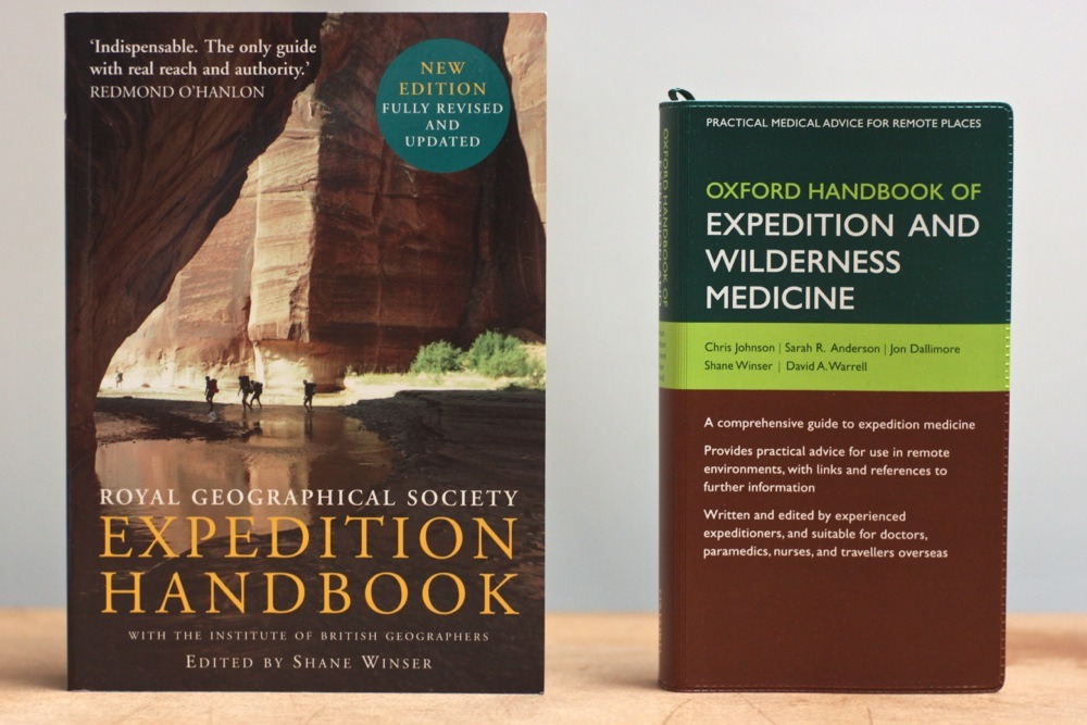
Two new books for the Rabbit Island library via the Royal Geographical Society.
Being based in London I had the opportunity to attend the RGS for the 2012 Explore Conference this past weekend. It was a very inspiring few days with many more than these few highlights—
+ Donating one of the Rabbit Island Quadrangle map prints to be preserved in the Royal Geographical Society library and archive.
+ Meeting artist/explorer Luce Choules and Simon Beckmann, co-founder of the Joya: art + ecología residency. Plans were set in motion to work together and share experiences/research in the near future.
+ Learning lots more about GIS and GPS in the field mapping workshop. Can’t wait to put the techniques to use out on the island.
+ The passionate introduction and closing comments from affable adventurer Paul Rose.
+ Hearing stories of survival and survey from such brilliant speakers as Sarah Outen, Ed Stafford, Mark Kalch and many others.
While Rabbit Island may be a small island and not as remote as some of the examples seen this past weekend, I know some amazing “micro-expeditions” will happen there over the next few years. The conference highlighted the importance of pursuing good research – both scientific and cultural – no matter the relative size or proximity to home.
Get outside, go explore.
—Andrew
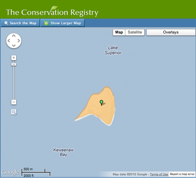
Rabbit Island was just added to the national Conservation Registry. The Conservation Registry is an online database that tracks and maps conservation, restoration and wildlife projects across the U.S. It was launched in 2008 and to date it is the most comprehensive repository of geospatially-specific project information in the U.S. By scrolling across the site’s map you can see most of the conserved land in the nation.
We came across this site while researching websites that combine mapping with prospective conservation planning.
It is a dream of ours to become involved in this space and collaborate with developers and designers to combine crowd-sourcing with mapping tools that document property lines, watersheds, and existing open spaces. As real estate evolves will property transactions occur with a conscience? Picture Things Organized Neatly applied to land use and you get the idea, as currently land parcelization is anything but neat from an ecological perspective anywhere outside of the mountains. We definitely need a better way to create islands amidst the grid!
At some point we need to choose what is needed of the environment prospectively, according to the science of sustainability (i.e. how much land is needed and where exactly it should be located to sequester/offset the byproduct of the rest of our activities), and then secondarily create policy and market solutions to obtain this in the context of disjointed lands previously cut up and assigned various non-natural functions (roads, parcels, parking lots, subdivisions, etc). Celebrating the value of the intact nature of the island (art!), exemplifying restraint with regards to its potential development, and then (hopefully) using this to help promote the idea that everybody should be able to access nature and learn from it, is, perhaps, one of the larger premises of the Rabbit Island project.
Lately we’ve been brainstorming with the team from Why Don’t We Own This? in Detroit and are working on some interactive maps using the 2012 Keweenaw Country Land Atlas and Plat Book. Stay tuned. With a little luck this will develop into a functional tool that helps the community buy and sell land with purpose. If you are interested in collaboration please get in touch.
The Rabbit Island Conservation Registry page can be seen here.
Other finds:
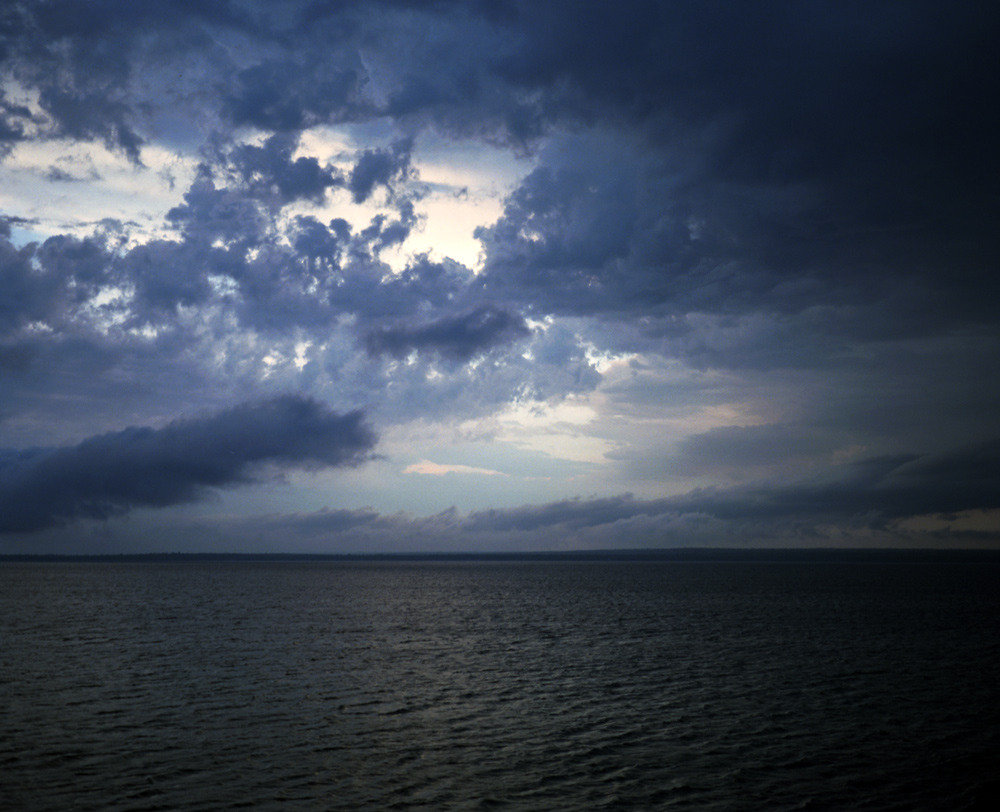
Take five minutes for a realtime sunrise over Lake Superior from Art’s Rock, Rabbit Island. August 31st, 2012.
-by Andrew Ranville
This rock, those trees, that clearing, the shimmering glow of the water, the smell of the white pines – it calls to you. You’ll find answers there. That sun, those slowly crashing swells, the endless blanket of blue.
The world there has this glow, this sway: its like the water you wade in through your eyes while standing perfectly still on land. There is not reason, only desire and unobstructed momentum to the places upon this land that call to you.
You can abandon the constructs of time, if you allow yourself, and come to know only the falling and rising of the sun, the push of the winds, the coming and going of clouds that cover and sometimes sprinkle the land, that can illuminate the night just as the shimmering lights of the north might.
You come alive.
—
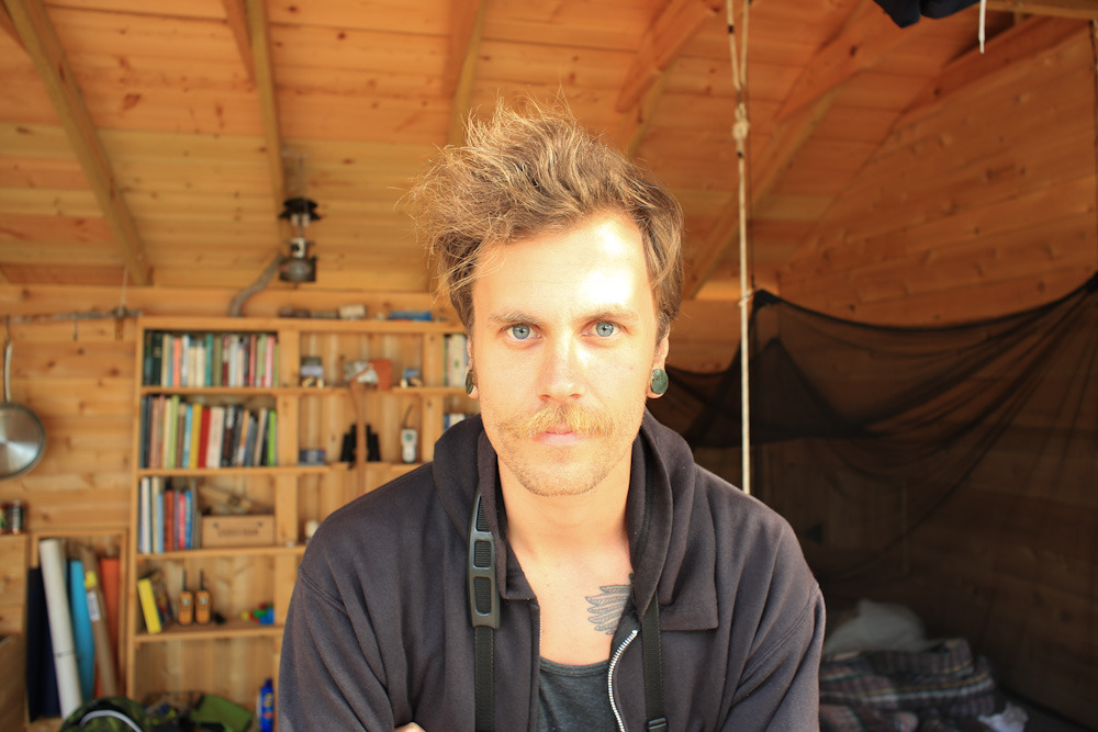
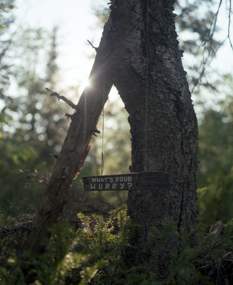
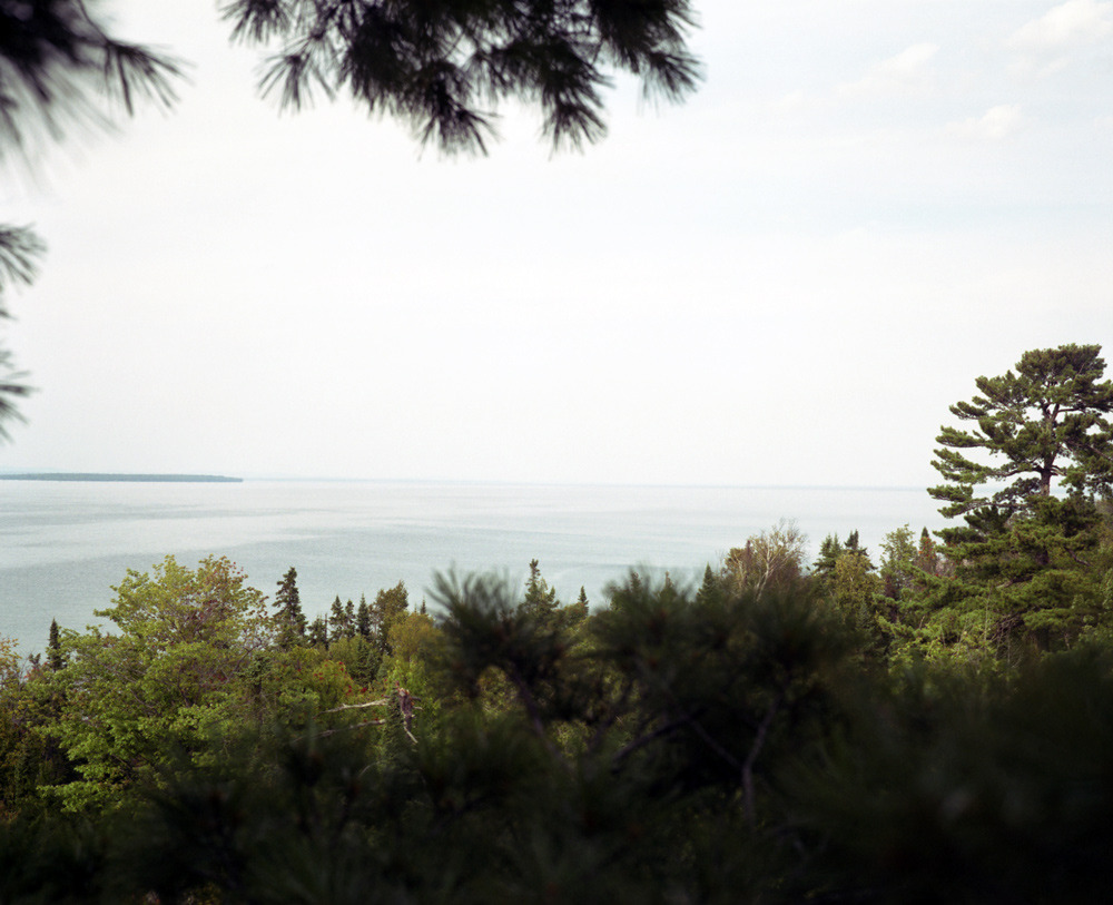
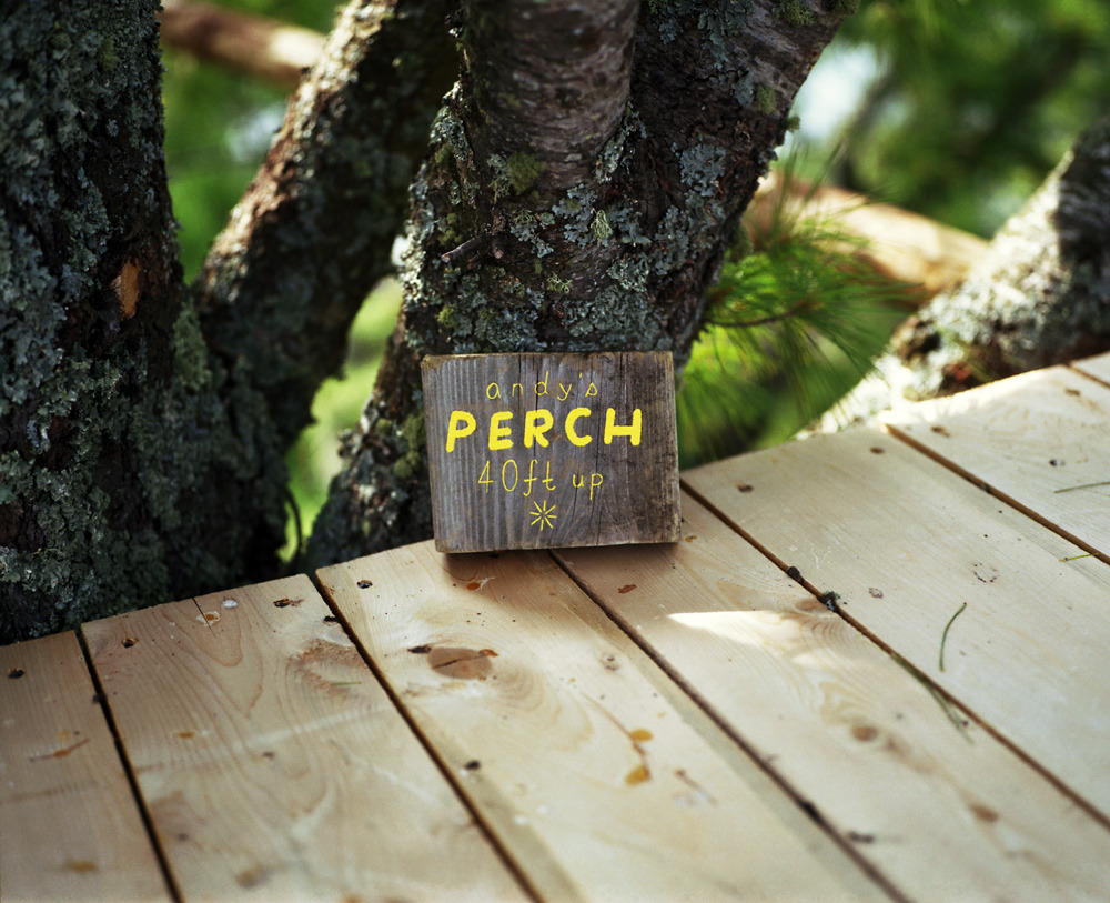
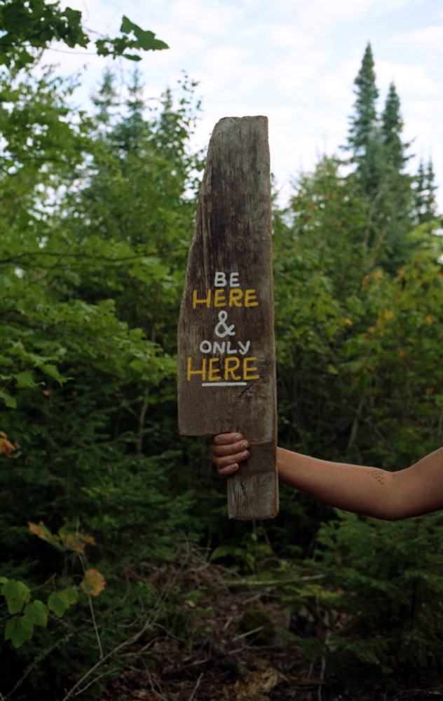
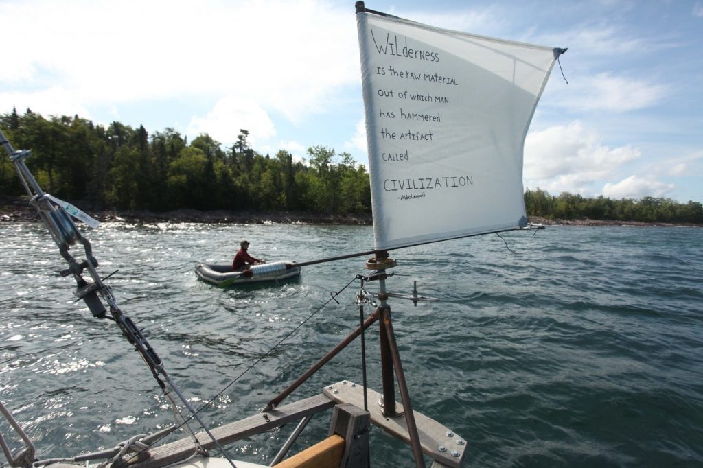
Words and photos from our friend Miles Mattison who joined us for a couple weeks late this summer. A photographer, illustrator, and artist based in San Francisco, Miles spent his time on the island taking photos, exploring, helping build, and creating a series of hand-painted signs to interact with the landscape.
See more of Miles’ work here.
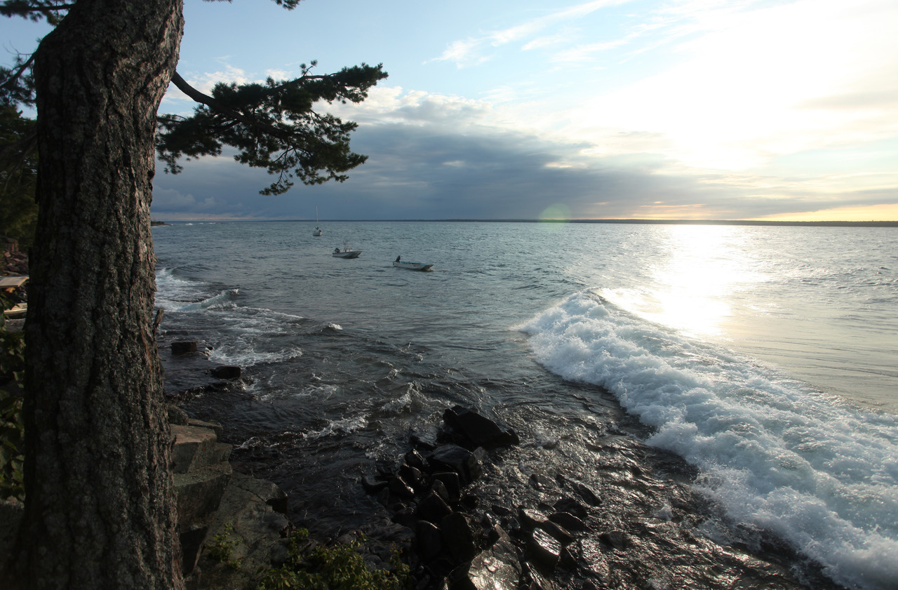
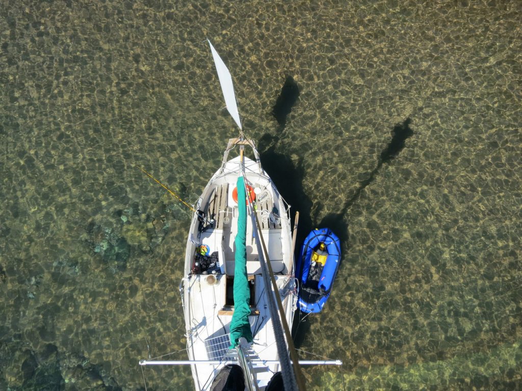
When an east wind blows above 25 knots the swell passing north of the island does an interesting thing: It rotates gradually to the south and breaks on our western shore. Waves traveling hundreds of miles from east to west reach the shallows of the island and wrap around them, crashing on shore at an angle approximately 120 degrees off of where they began. It is a pretty amazing phenomenon–a bit counterintuitive, even–and one we wouldn’t have believed until witnessing it drub our boats on occasion. This stuff definitely wasn’t in the manual.
Wave scientists explains this with a concept called refraction. According to this principle as a swell passes the rounded edges of an island gravity, momentum and friction force the axis of the wave to rotate to keep a constant relationship with shoreline and each wave maintains a fixed angle to the changing water depth. Given the curvature of the northern tip of Rabbit Island you can find yourself standing on the shoreline in front of the main camp with the wind blowing your hair from east while waves crash over your feet from the northwest.
This is not ideal for our moorings which take sizable waves even when completely protected from the direct force of the prevailing wind. On nights when a good nor'easter blows we sleep with one eye open and take turns waking up at two hour intervals to shine headlamps on the water amidst the crashing waves and blowing wind. The chance of discovering a severed line, failed cleat, or a boat adrift has a way of inducing restlessness, let us tell you.
Over the last three years we’ve refined our mooring design, hardware and placement accordingly. After much hands-on experience we’ve come up with a solution utilizing thick ¾" line, iron anchorages, underwater buoys to float heavy galvanized chains, stainless thimbles at all intersections of line and metal, stainless washers and nuts, strong climbing knots, rotational swivels, stainless quick links, shock absorbing snubbers, locking carabiners and rope floats to keep the mooring line off of the abrasive bottom. The result is low impact, completely removable and easy to manage. It shows due respect for the forces of Lake Superior with minimal excess.
We’ve also found that when faced with a storm shifting the boats even a few boat lengths to the south down the shoreline can matter quite a bit. The above photo from August illustrates this idea well. Marlin’s sailboat in the distance was in the best position to handle the large refraction waves and wasn’t disturbed whatsoever. The Montauk 17 in the middle of the photo took a few large swells but rode them without much fuss. The smaller Whaler 13, on the far right, however, took an intermittent pounding when sets of waves broke over her bow and stressed her mooring line to near failure. Thankfully the little boat lived up to its design and was, indeed, unsinkable.
All of this practical hydrology has put us through an apprenticeship of sorts, and we’ve found the work interesting. Dealing with the waves and wind on the horizon is a constant variable on a remote island in Lake Superior. On the bright side, however, when heavy weather rolls in it is never without reward. When our moorings are pounded from the northeast and our boats are exposed to swell, one thing is also for certain–surf’s up! And there is also lots of time to think as we’re not going anywhere a while.
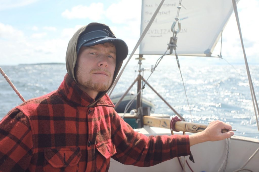
It’s thundering and lightning as I write this, and I am feeling the same feelings of vulnerability I was feeling this summer while weathering lightning storms aboard my little sailboat. Certain reactions have become ingrained in me after spending hundreds of hours and nearly five thousand nautical miles living and traveling on Lake Superior over the last three years. Rabbit Island was one of the most memorable highlights of those hours and miles, storms, sun, weather, and people.
It came and went three times over before I was able to stay for any appreciable amount of time. I learned of it by chance while my girlfriend was looking up pictures of cabins on the internet. After doing some research on it, and who was behind it, I decided I must go there. It just so happened I had already taken the forthcoming summer off to go on a sailing odyssey on Lake Superior. And so I scribbled out “Traverse Island” on my nautical chart and printed in black marker “Rabbit Island”.
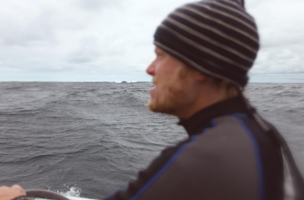
Months passed. I was able to launch my twenty foot sailboat “Voyageur” on March 28th due to the unusual weather patterns that were hovering over the Midwest. Susan and I left Washburn, WI, aboard Voyageur on April 21st and after a few stints at the tiller, a few minor issues, weather, and waves, we arrived through dense fog at Rabbit Island.
But our stay was short. We hiked part of the island, then started a fire in Voyageurs little wood-stove to warm up. The weather was foreboding and the island lacked good protection had a storm arose. The rocky bottom wasn’t good for anchoring, and being April I wasn’t about to dive into the frigid waters in order to get a good set with the anchor. So naturally, we left for Grand Traverse Bay, further North up the Keweenaw Peninsula coast.
Susan, Voyageur, and I continued to sail up the Keweenaw coast to Copper Harbor, then over to Isle Royale and then into Canada, eventually turning to head for home once we had hit the Slate Islands.
It had been two months since that cold and foggy day with Susan on Rabbit Island when I once again found myself battling a headwind, waves splashing spray across my face, trying to reach the island. I made it halfway before turning around and heading back to the Keweenaw Entrance for refuge. A few days later I tried again amidst much better weather.
It was calm and I anchored on the West shore. I dropped my anchor and watched it drag across the bottom, bouncing off rocks, until it finally caught underneath a large boulder. I jumped into the dinghy and rowed ashore.
“Hi! You must be Marlin! Welcome!”
I was greeted by Rob and Ty, and not long after this greeting we got to work on the obvious: a sauna.
But the weather wouldn’t have it and the next evening (after watching Voyageur bounce around in the building waves) I decided to go back to the Keweenaw Entrance and hideout from the impending bad weather. While I was leaving the island and making my way back to the Keweenaw Entrance the waves started to build along with the wind. I noticed a cruise ship traveling North up Keweenaw Bay. I had never seen a cruise ship on Lake Superior and I was sort of dumbstruck, which caused my mind to turn. It was in that momentary lapse of attention, attention which the inland sea was by then demanding of me, that I got caught broadside by a large wave. In an instant several inches of water had collected in the cockpit and I was soaked from head to toe. I arrived back in the South Entrance around midnight.
The days passed slowly as high winds ripped across Michigan’s Upper Peninsula until I once again found myself sailing the ten miles back to Rabbit Island. This time I was determined to stay for more than a day and had decided I would dive down and set up a temporary mooring for Voyageur by jamming my anchor underneath the biggest boulder I could find. This I did upon arriving and the anchor held well over the weeks that followed.
…
Excerpt from the Memoirs of Peter Lahti:
“…the [rabbit bay] district was a veritable wilderness, covered with dense forests—possessed of a wild and somber beauty…” —Helen Torkkola, 1939
We worked on the sauna. We swam. We hauled lumber from the mainland. We built things and shared ideas. Friendships were made and meals shared. We popularized a new gauge of measurement: The Rabbit Island Titsel. We all felt like we were a part of something; because we were a part of something.
Rabbit Islands’ resources have never been exploited. Rabbit Island is a wilderness in one of it’s truest forms. It is now protected from being developed in perpetuity. This is the most important aspect of the island to me, and this is why I went through so much trouble to get there. I wanted to see first hand what one person could do. One person who was driven not by greed, but by the opportunity to save something. Having the self discipline to make a decision based not on financial investments and returns, but instead on the principle of our future, is the art of being human, and right now it’s what we need more than anything else.
So Rabbit Island will remain “a veritable wilderness, covered with dense forests; possessed of a wild and somber beauty…” Forever. The true artists that travel there today create ideas fed by the foundation of the island itself. It’s the true artists, the ones who create not for attention or money but for the emotional rush provided by the creation of art, who exemplify the preservation of Rabbit Island. It is these artists who are preserving the arts, and the art of being human.
- Marlin Ledin
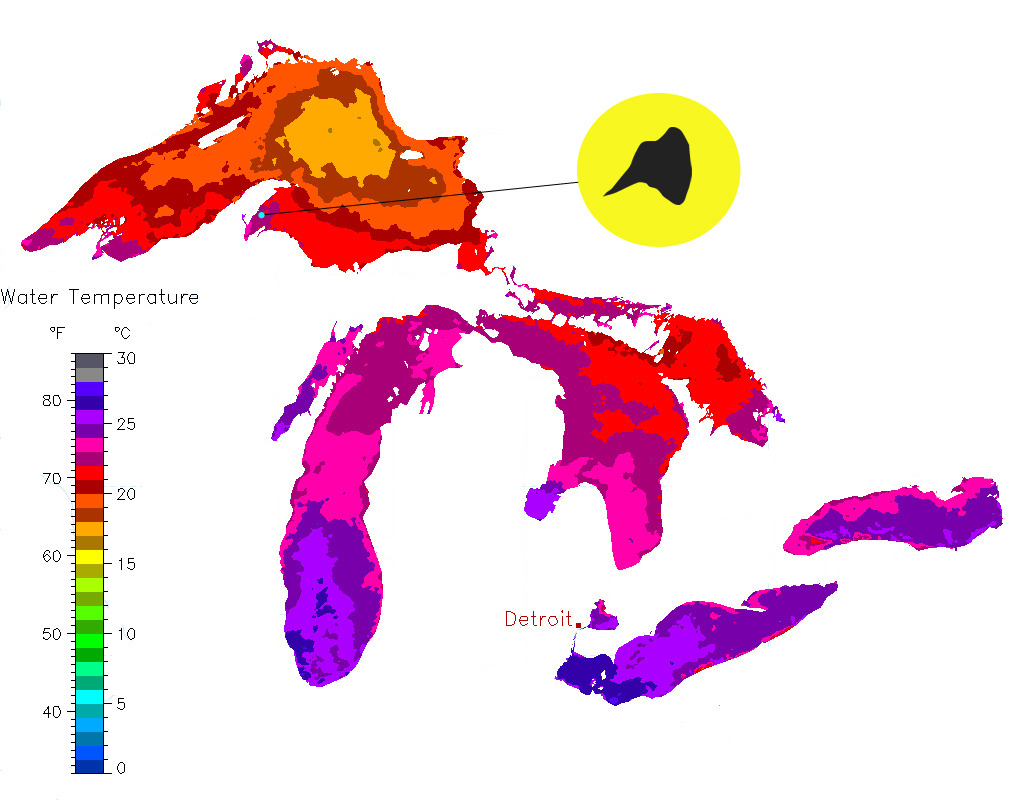
The oral history of the changing Lake Superior water temperatures it is striking.
This chart illustrates one of the warmest days ever recorded on lake superior, July 24th, 2012. It is sad, but well documented, that Lake Superior–the sole remaining ecologically sustainable great lake–is being pushed to new extremes by the changing climate. We’ve been noticing things change on the island.
Many of us involved with Rabbit Island are in our twenties and early thirties and grew up with Lake Superior as long as we can remember. For us it has been significant to witness temperatures on the ‘big lake’ warming, even since our childhoods in the early 80’s. Swimming used to be a challenge back then, even on the hottest days of summer. Now it is tolerable from late June through September. The winters have changed too. Not since the 1970’s has ice stretched all the way between Rabbit Bay to Rabbit Island and long gone are the tales of strapping on ice skates after a calm freeze and gliding over three miles of ice to the island, around, and back. Also gone are the stories of packs of coyotes stranded on the island after having crossed ice bridge which blow offshore.
For the generations before us the changes are even more amazing. We can only imagine. What was this like? How have things changed?
If you are of an earlier generation and have a personal account of the changing lake please consider sending it along or posting it on our facebook page. We’ll add each story submitted to the archive below for the sake of posterity.
Decades or centuries from now the island will continue to exist in its natural state, though the nature of the land and surrounding lake may be of very different character. It is possible that the climax forest community may drift. It is possible that balsams will give way to birches or maples. One can only speculate. Regardless, it will continue to be interesting to read the observations of those who witnessed such events unfold over the frame of reference of a lifetime.
+ NOAA real time graph of Great Lakes surface temperatures
+ The lake is a brisk 52 degree around the island today, October 24th, 2012.
+ This season we swam to hang the moorings near camp on May 15th and swam again to pull them on October 1st.
+ There are many related articles on this subject. Some of the more interesting first person comments from the one we have linked have been copied here (and edited slightly for clarity) and added to others which have been submitted:
As a life long resident of the North Shore of Lake Superior, I can tell you that the beaches are full of kids and adults taking full advantage of the fine swimming conditions. When I was a kid in the 1960’s, a dip in Lake Superior in July would be life threatening. A game we played in summer was to have 4 or 5 kids stand knee deep in the lake and see who could stand it the longest. The cold gave unbearable pain and few kids lasted more than a minute or two. It has been decades now since we had large ice cover of the lake in Winter. I can not remember the last time open water froze over; the harbor freezes up some years but never the open water. Again, when I was a kid the lake froze up every winter. Large Ice Breakers worked in April and May to open shipping lanes. In the 1970’s we had ice conditions on the 5th of June. Now we no longer have Ice conditions in January! To anyone living decades along the Lake Superior Shoreline, climate change has been undeniable. The warming has been extreme and rapid over the last 20 years. That is why nobody around here goes for the climate change denial story. When you live it, it is hard to deny.
I just went for a swim in Lake Superior in the warmest water I have ever experienced. The North Shore is like bath water. It is not even August yet! If the heat and sun continue as they have, we will break the record warm water temps by a massive amount. I would bet my life we don’t see a piece of ice on the lake this coming winter. In the past, lake superior water would kill you in minutes, even in summer, now we all run down to the beach and jump right in. I saw long distance swimmers training far out in the lake today; this was unheard of at any time around here.
During the hot summer of 2010 I spent four consecutive hours immersed in Lake Superior (hunting for just the right stones for finishing prizes for the Marquette Marathon). But, like noted above, when I was a boy being in the big lake for more than a few minutes was unthinkable. Now the beaches are flooded with people, in and out of the water.
I remember the water being really cold in the 1950’s–freezing cold. When you first went in you thought your feet might turn blue. You just had to take the plunge. After being in for a while you would get used to it but pretty soon had to get out and lie on the rocks to warm up. And you could only swim for a few weeks at the end of July and early August. That was the swim season. The water was much clearer back then too.
I was born on the shore of Lake Superior in 1953. During the early 1970s, I paddled a canoe on Lake Superior during early June encountering icebergs. For the past 12 years, my brother and I visit our cabin each March with a goal of skiing on, or on the shores of, Lake Superior. For most of the past 5 years, we’ve kayaked on the Lake as the ice has moved out. One year, my brother swam in Lake Superior as the 60 degree March temperatures were quite warm.