We’re excited to be a part of the first ever TEDx event hosted in northern Michigan’s Keweenaw Peninsula. The event is sponsored by Michigan Technological University this Saturday, March 23rd, between 9:30am and 7pm EDT. The theme of the event is Journeys.
Andrew Ranville, Rabbit Island’s founding Artist in Residence, will be speaking about his experience living on the island over the past two summers and how it has affected his arts practice and world view. He’ll also be talking a bit about what’s coming up for the project. Currently he’s en-route from London, UK, and will be landing later tonight up north so long as the runways are clear of snow.
Tickets are sold out but the talks will be broadcast live online. Andrew’s talk will be opening the event just after 9:30am EDT so make sure to log on early!
Cheers to everyone who put the energy into organizing this event. Michigan’s Copper Country is so darn special.
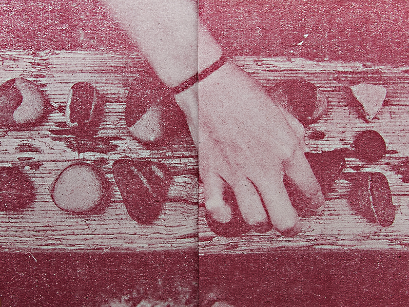
Sarah Darnell, one of the Cabin-Time crew members who spent some time with us this past summer just released a publication of drawings related to the work she did on the island.
Pick up your copy for only $6 from Issue Press, an independent publisher of art books and prints in Grand Rapids, MI, USA.
Cabin-Time recently completed the fourth chapter of their nomadic camp earlier this month in northern Michigan’s Wilderness State Park. Check out some photos of their trip.
We’re looking forward to collaborating with Cabin-Time again in the future. Remember to save a copy for the Rabbit Island library, Sarah!
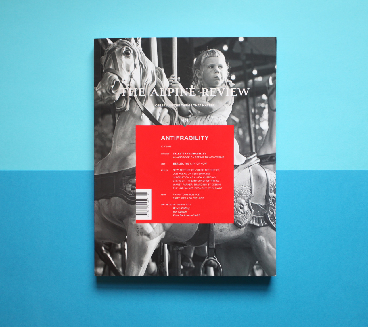
The good folks at the The Alpine Review will be featuring some text and photographs from Rabbit Island in their second issue, out this spring.
The Montreal-based bi-annual magazine tracks art, culture and ideas around the world. Below are a few words from the preface of the inaugural print. They remind us a bit, perhaps, of sentiments found in Foucault’s The Order of Things.
Exploring ‘the order of things’ is definitely a premise of the island project. Can the civilized and the native become more sensible complements via better organization? Can the collusion of modern ideas (genetics, the web, mapping, social business, art, etc.), lead to new, more fundamentally classic, rules than currently stand as policy? Can metaphors from a remote island apply to a broader setting? We’re hopeful. Regardless, we’re excited to collaborate with this beautiful new publication.
These are fascinating times. It is a common vanity to believe that one’s generation is the most tumultuous, most evolving and most important. Perhaps it is is true. Perhaps it is nothing more than historical narcissism. Nevertheless, there is an uncanny feeling that something profound is taking place at this very moment. This is not a gradual evolution. This is an accelerating shake-up spanning industries and cultures: a massive tearing-down, redesign and renovation of processes, systems, structures and perspectives.
The magnitude of these rapid changes intrigued and discomforted me. After speaking to friends and colleagues it became clear that I was not the only one. I realized that the passage of time, the impetus of career and excesses of consumerism had started making me numb; like the pins and needles that climb into your toes when you’ve been still for too long, I felt compelled to shake it out. It was time for a new project: The Alpine Review.
[…]
Modernity rarely allows us the luxury and liberty of mindful reflection and I have been truly fortunate to spend a year doing just that: traveling, discussing and debating with people I admire, connecting with new projects, and actually taking the time to look listen and question. What started as an exciting conversation with my co-editor has snowballed into a compendium of ideas and observations from people all around the world trying to make sense of things. I’m honored to present you with the inaugural issues of The Alpine Review.
Louis-Jacques Darveau, Editor
This is going to be a helluva collaboration.
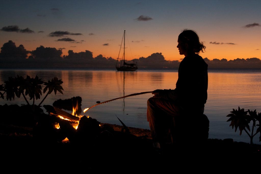
In September the phone rang in New York, about a month after most of the activity on the island was wrapping up. It was Liz Clark.
“I was wondering if I could visit Rabbit Island later this year. I’m coming back and am going to start writing a book. I’d love to find someplace quiet.”
We said yes, of course, but since we weren’t set up for late-season expeditions to the island—cold weather gales, no enclosed shelter, a frigid lake—we decided to push her residency back to this upcoming summer and are currently working on the logistics from opposite sides of the globe. (Liz is somewhere in French Polynesia right now.)
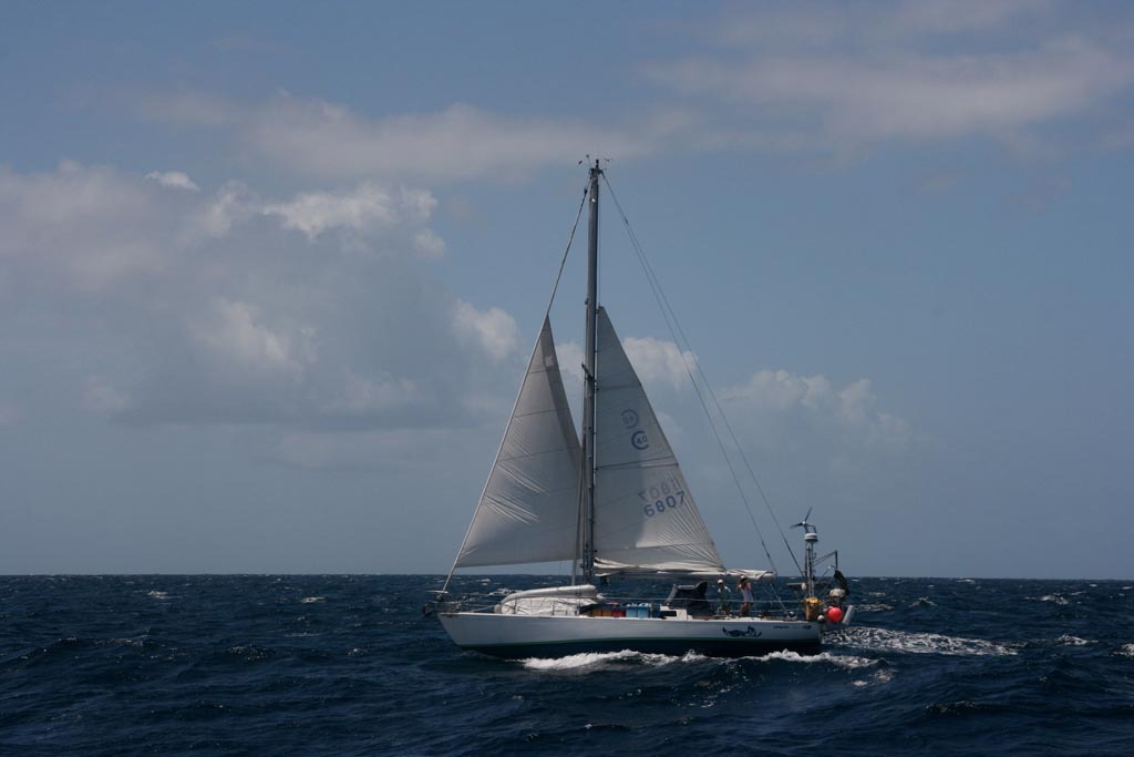
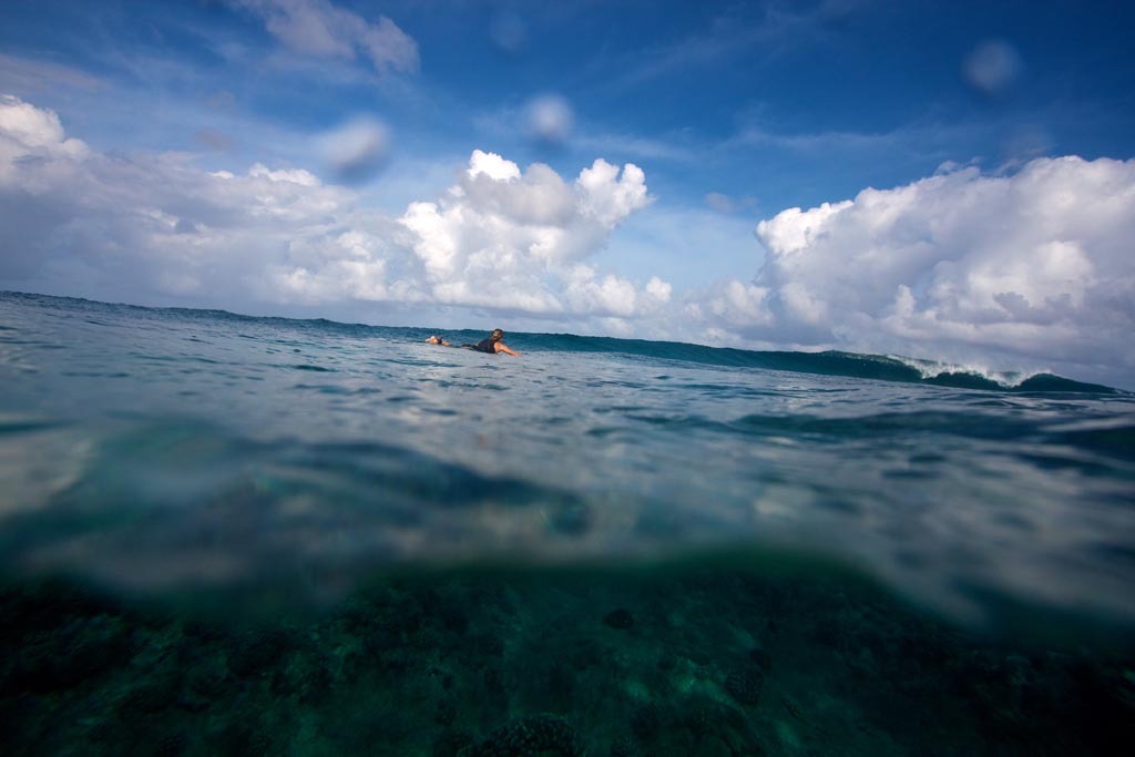
Liz Clark has a good story. Since 2006 she has been sailing her 40 foot sailboat, Swell, solo around the remote atolls of the South Pacific. She set off from southern California after college and sailed down the coast of Baja Mexico and Central America. After that she made a break for the Galapagos Islands, and then, in a single charge, went for it across the Pacific. Just imagine—a young woman, a sailboat, the Pacific ocean, twenty-eight thousand miles, and, well, six incredible years.
Liz also happens to be a really good surfer and a committed environmental writer. So good in fact, and so well-intentioned, that she’s been given the title Surf Ambassador by a company in California you might’ve heard of.
Though we digress, perhaps. Let’s imagine a few sailing details for a moment: The number of days she’s spent on a sailboat—cruising solo for more time than it takes to earn an undergraduate degree; the number of times she’s glanced at the wake parting with regular irregularity behind Swell; the sound of halyards clanking against an aluminum mast and how they must’ve faded into the background, like sirens in New York City; the slap of the mainsail’s leech at different points of sail; the number of times she has checked her tells; the instincts she has developed towards her rigging; the number of days she’s been soaked at the helm; the feeling of securing hatches in weather before ducking below for a night, thousands of miles from land; the maintenance she’s performed during a constant battle with salinity; the trust developed between sailor and ship; the occasional notes from a digital navigation instrument, or static over a long-range radio.
It is difficult to conceive.
Sailing is compelling. Sailing is intrinsically a matter of good design. That is, if you are sailing, you are part of an elegant and functional idea manifested physically. You are connected to the physical world with sophisticated intention and simple execution, few degrees from baseline laws. (The same can be said of surfing, of course, and this mustn’t be a coincidence.)
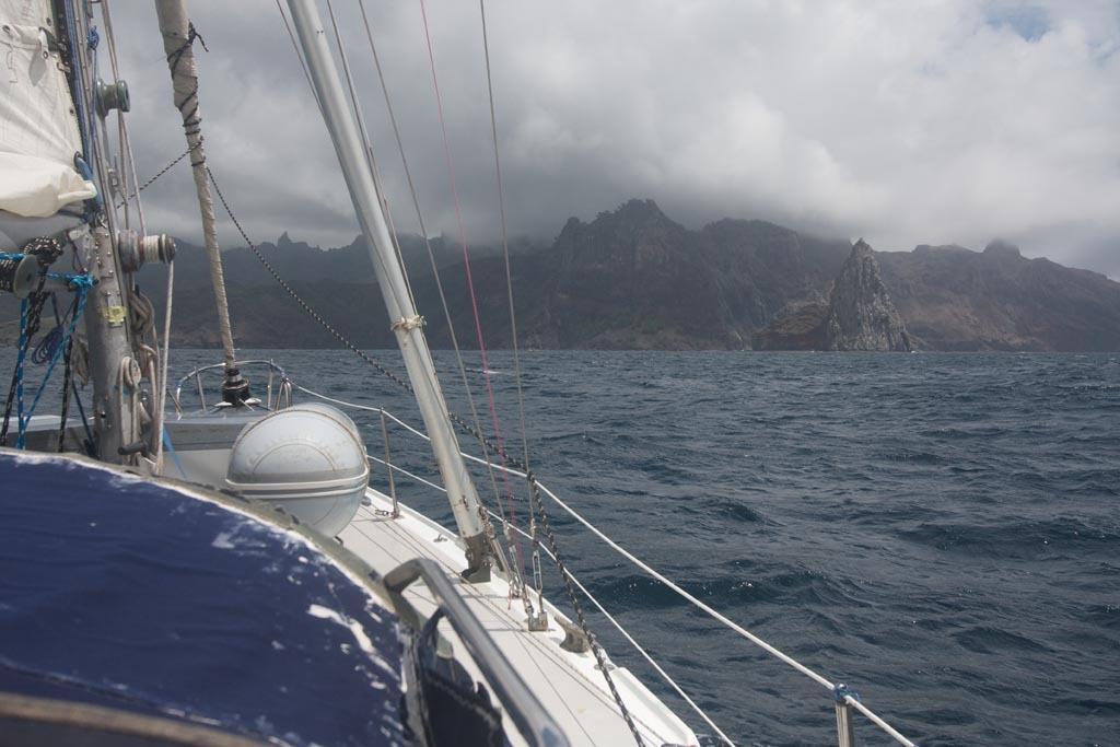
In design and purpose, Rabbit Island and Liz’s voyage have similarities. On both island and sailboat less is more, and simplicity is ideal, because you have to choose carefully what you bring. In fact we’d love the island to become analogous to a well-designed sailboat. It is a nice idea.
Liz has been illustrating intelligent principles with precision during her voyage, living a well-curated life born initially of choice, and then, while at sea, necessity. She is leaving little trace and impacting the wider culture. She’s been traveling under the power of wind, generating electricity from the sun, eating fish and fruit from her surroundings, accounting for inputs and outputs, writing, surfing, and—most interestingly—becoming a scholar of the ocean via experience, witnessing every inch of water along a zig-zagging line of jibes, runs, beats and reaches between California and French Polynesia.
Liz has seen the plastic, swam the changing coral beds, dodged the container ships, reefed her sails through weather, witnessed the effects of overfishing on island communities, seen the spoiling of paradises via development. But she’s also witnessed the diamonds that have been spared such fates and the remnants of wild places near the antipode of North America. She went for it and has spent six years noting the byproducts of our land-based externalities on the sea.
Every day, every night, every sunset, every storm on the horizon, she’s taken record amidst the most remote expanse of water in the world. She has been crossing the ocean while we’ve been on land.
It is said that the only thing people have, really, is their experience—the books that they’ve read, the people that they’ve related to, the art they have seen, the language they’ve been taught, the lands they have visited, the family that instilled values within them. We are excited to have the opportunity to learn from her experiences, share our own, and create dialogue amongst the island’s resident artists, writers, builders and chefs.
This spring she’ll be taking a sabbatical from sailing and will begin creating a written record of her story. During July and August she’ll be spending some time on Rabbit Island.
Which brings us to surfing. Liz has surfed some of the best breaks in the world but she’s never seen the rocky shoal off the southeast point of Rabbit Island on a windy day. We can see it now, an angry summer front pushing a strong east wind across the sandstone reef. Sizable lake sets. Glaring sun. Liz will be the third person to surf Rabbit Island, and there’s little doubt she’ll show the first two how it’s done. But that’s cool. Really, who can compete with proper California kid on a wave.
If anyone knows how our life on land—what we consume, what we create, what runs off, how we divide it, and the story of stuff—effect our broader world, it’s probably Liz Clark. Who better then to invite to our residency on a patch of land that was spared development, harvest and subdivision, to brainstorm ways to organize things more intelligently and celebrate the continued existence of natural places of scale.
And one more thing. Perhaps the best part—which we haven’t told her yet because it’s a bit of a secret. We’d been following her blog for several years, living vicariously through her as she sailed Swell across the Pacific. This is part of what makes the collaboration so special; the serendipity of it all; ideas coming together; a phone call out of the blue from across the web.
May good things come!
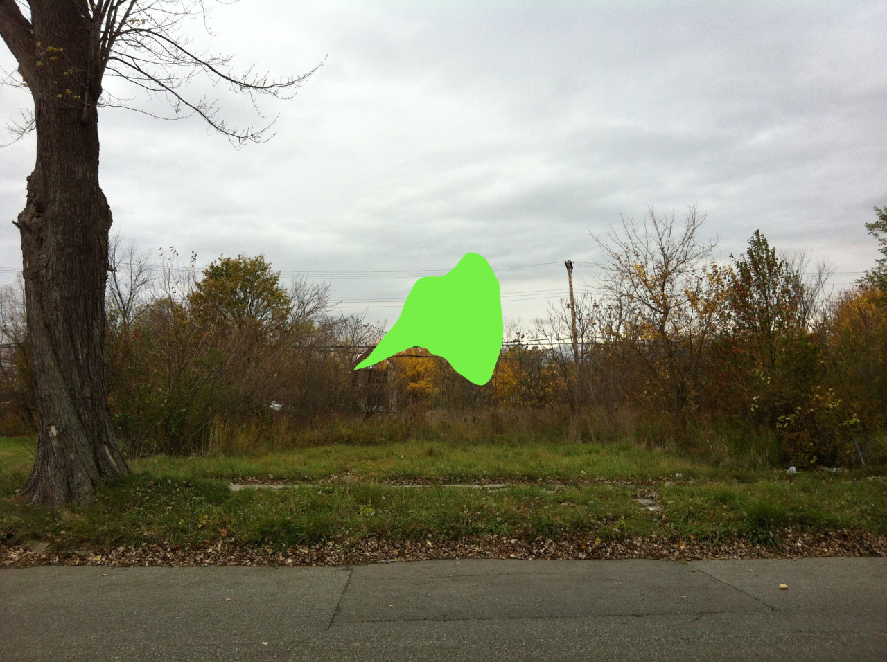
If you unbuild it, they will come. Rabbit Island + Detroit.
We’re working on a new Rabbit Island conservation project and installation in Detroit. In the city’s September tax foreclosure auction of over 20,000 city owned properties we collaborated with a friend from Paris (which seems somehow fitting given that Detroit was settled by French missionaries) and purchased a vacant lot on the east side of Detroit. 1545 Pennyslvania Street. Have a look.
We’re currently brainstorming several ideas for the lot but are thinking about transplanting young pines and other trees from Rabbit Island and simply walking away, leaving the parcel to its own fate. The context will be different than on the island, of course, which is important, yet restraint will continue to constitute the notable intention. A sign alluding to wild lands might be placed on the parcel stating only, “Leave No Trace”, and thus our claim will be staked.
The project will become, over time, an example of the ethic of Rabbit Island amidst the re-invention of an American city. It will be an ongoing exemplification of restraint and evidence of the opposite of traditional market forces; a decision based upon the widest possible balance sheet; a criticism, perhaps, of how American cities and suburbs were cut from the land in the first place.
It is a pretty simple idea, which is why we think it should work. And it will only get better with time. The idea of Rabbit Island will spillover to Detroit, as it could any place. Art and the organization of land will further mingle and there will one day be an old growth climax-community stand of trees at 1545 Pennsylvania Street representing the bloodline of an unscathed remnant of Michigan’s north woods. Forever.
In the future it is our hope that when the parcels adjacent to ours come up for sale we will be able to buy them via a crowdfunded effort, have the property lines in the plat book removed in legal terms, and increase the size of the project. Un-subdivision will be thus exemplified. The concept will hopefully spread.
Details:
+ The lot was purchased for $600 in the yearly Wayne County tax foreclosure auction.
+ We outbid someone who had bid the $500 minimum two minutes before the auction ended. (Gotcha!)
+ Our taxes are $49 per year.
+ We used www.whydontweownthis.com to search for and facilitate our purchase. Many thanks to Jerry, Larry, Mary and Alex at Loveland Technologies. These guys are on the forefront of some very big ideas. (See 1454 Pennsylvania on WDWOT?).
+ The Detroit land auction happens every year in September. This year 11,972 properties sold to 2,198 bidders while 8,686 went unsold at $500. It is estimated that 43,000 more properties will be seized by the city and added to the auction for 2013 due to failure to pay taxes. Get some friends together for next September and take a leap. There is so little downside.
With the Rabbit Island + Detoit our fundamental proposition is that doing less is more with land in the context of the contemporary state of unbalanced and irrationally distributed subdivision and development, which has historically served markets before ecosystems and society. Some related essays can be found here, here and here.
With this initial physical gesture we will be working to spread the idea of un-subidivision of land as a cultural premise that allows for better organization of the urban and the wild relative to one another. People living close to one another and sharing resources is better for the environment, of course, and undivided natural space is better for the environment, of course, but what we now have is a muddling of these pure ideas across much of our land, which is nuts from the perspective of the future. See this print of every street in America.
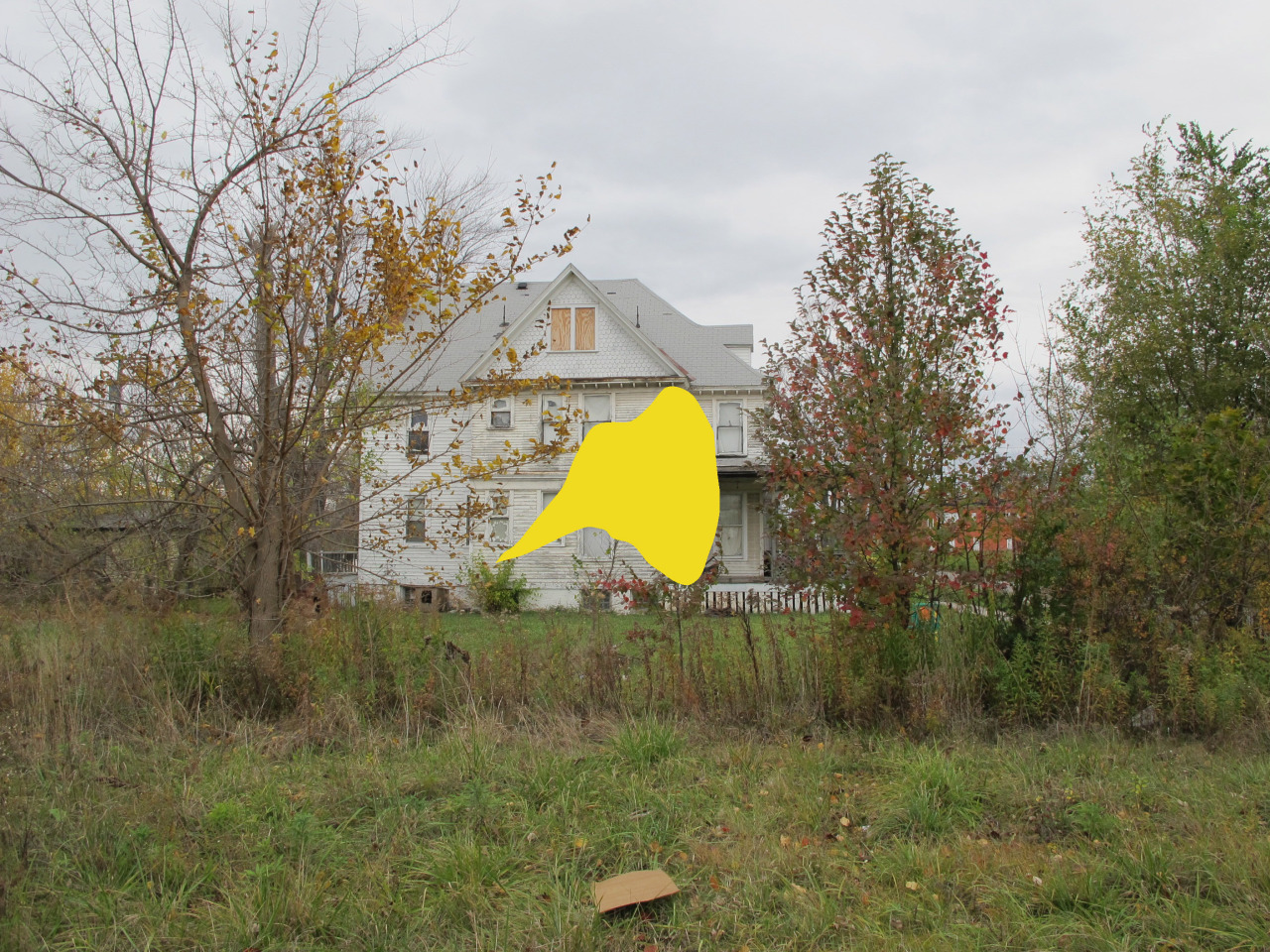
In a twist to this story there were a few other people who shared similar sentiments and purchased land in Detroit with the intention of not developing it and re-aggregating it on the map. It just happens that one of these people was John Hantz, a wealthy businessman and philanthropist from Detroit. Through his company, Hantz Farms, he just purchased more than 1,500 non-contiguous city-owned lots for $520,000, or about $300 per lot, between Van Dyke and St. Jean Street and Jefferson and Mack avenues, including the majority of the land behind our project at 1545 Pennsylvania–an open space which happens to be one of the largest open spaces within city limits. On this land his company will be planting an oak forest. After four years—if the company is still in compliance with all city-imposed conditions—it has an option to acquire an additional 180 acres within a mile of the original purchase site. A forest!
Just think about it–a 140 acre oak forest three miles from the Detroit Opera House. This could very well represent the closest proximity of forest to Opera House in the world. The citizens of Detroit will benefit incredibly from this diversity as the ends of the spectrum from nature to higher civilization become bedfellows.
This is profound. This has never been done before in the context of a major American city. Hantz has executed a rational re-organization of land on a significant scale in favor of un-subdivision. He used an economic model favoring open space over development, combined, perhaps, with philanthropy. Regardless, this is an act seldom accomplished. He is using land for the benefit of both nature and society, on a large scale, in its near natural state, on property that was previously developed and divided. We tip our hat. It wasn’t without controversy, but he realized it.
Another project underway as a result of the recent auction is that of Jerry Paffendorf and the guys at whydontweownthis.com. Their team collectively purchased 10 houses in the Springwells neighborhood of Southwest Detroit and are tearing them down. We can’t wait to see where this goes.
Though we found out about the location of the Hantz Farm deal after having sited and purchased our parcel, we surely assigned value to the lot we purchased in a similar way Hantz Farms did. Our interest stemmed from the simple fact that 1545 Pennsylvania was surrounded by significant open space with novel environmental potential. It struck us as a perfect opportunity to explore the concept of un-subdivision in an urban environment where the toothpaste was already very much out of the tube.
Hantz Farms was also the subject of a July, 2012, Wall Street Journal article. It is worth a read and if you view the interactive map you will see that the backyard of the Rabbit Island + Detroit project is highlighted for purchase by the group. It can also be seen here, highlighted in yellow, on our Flickr page.
Every person deserves to have access to open space which represents functioning natural systems. The larger the size of these open spaces, the better. These are ideas that are possible to reinvent on an significant scale at this moment in time in Detroit and other post-industrial cities across the nation, which is wildly exciting. The idea that we can fix our large scale development mistakes is even more so.
Please check-in on the lot in 100 years and see if our thesis proves reasonable. And please get in touch if you’d like to collaborate.
p.s. We’re planning a camping trip!
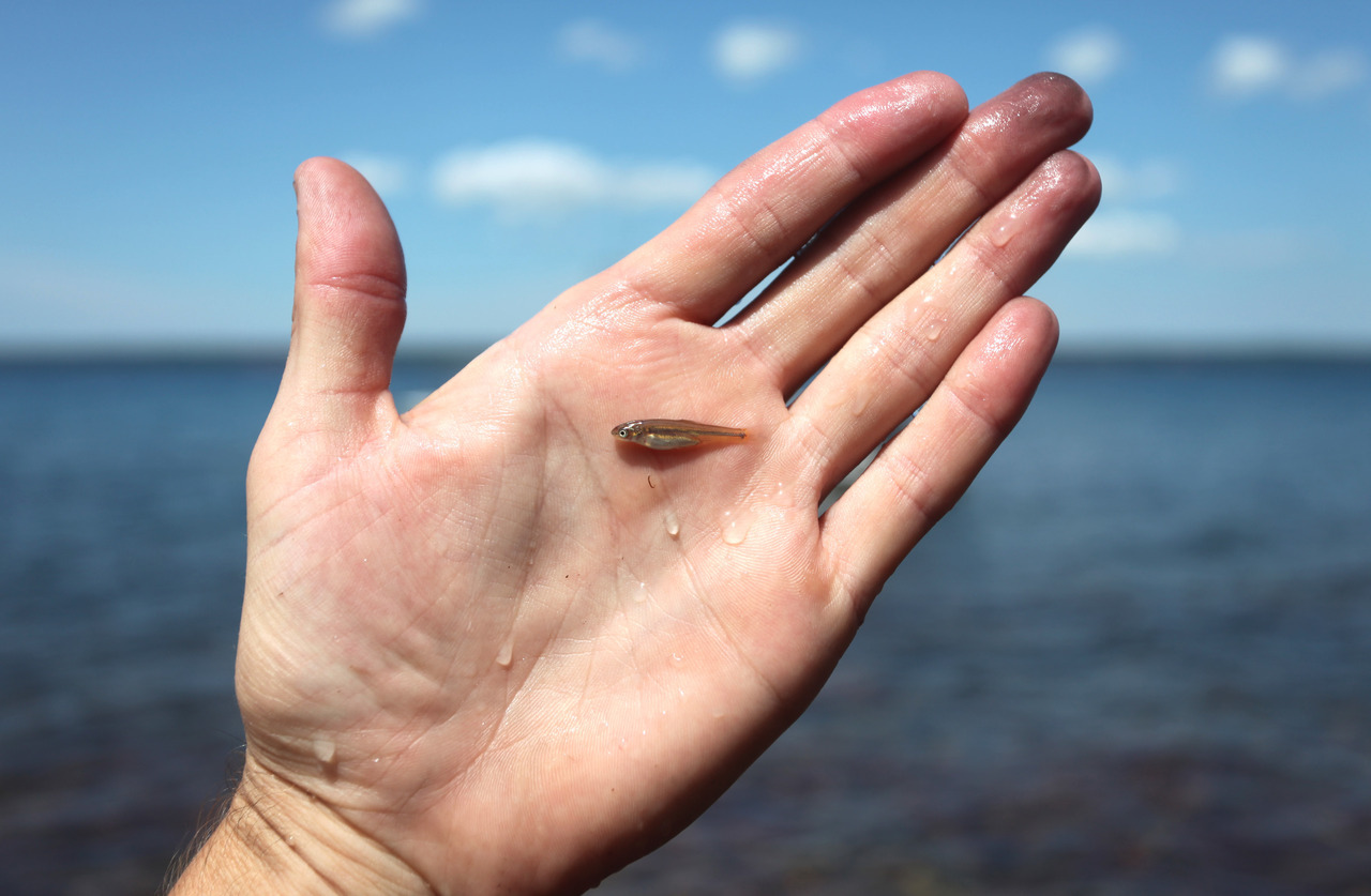
A Lake Trout native to Rabbit Island. Fall in love with this fish. It represents a very big idea.
“The great abundance of fish and the convenience of the place for fishing have caused the Indians to make a fixed settlement in those parts. It is a daily mana, which never fails.” - Antoine Cadillac, French explorer of the Great Lakes and founding father of Detroit, 1695
“What of the Great Lakes… and where are the fish?” - Chicago Times, 1881
Swimming amidst the rocky shoals surrounding Rabbit Island is one of the last remnant populations of native “lean variety” Lake Trout on the southern shore of Lake Superior–a rarity indeed. In the fall of each year Lake Trout migrate from the depths of the lake where they pass summer months and congregate around shallow, rocky features to mate, as they have for thousands of years.
Little trout. Big idea. This little trout is a wonder. It swam past our camp as we were doing our dishes and with one lucky swipe of an enamel bowl we were afforded a brief and rather spectacular moment. (That is dish grease on the tips of fingers three and four.)
We might as well have been holding a California redwood in the palms of our hands as this trout carries with it a bloodline undisturbed for thousands of years and is an heirloom if ever there was. It hatched from an egg between sandstones in the shallow water around the island, laid by a mother and fertilized by a father, both of whom spent their lifetimes swimming in water clean enough to support biologic function, in virgin form, on the largest of of environmental scales (as did every generation of lake trout before them). For this to continue to occur, year after year, the system didn’t need anything from us humans except for our relative absence. Our relative restraint.
Since the glacial age, lake trout in all five Great Lakes had sustained themselves in similar fashion until very recently. The northernmost lake, Lake Superior, however, (that grand lake!) is the only remaining lake that has endured the additive influence of human settlement over the past 300 years and yet maintained a naturally reproducing population of wild trout–that is, a population of trout that didn’t rely on artificial stocking and that wouldn’t die out if not replaced by fisheries biologists. It has gotten some help along the way, of course, but it never lost a viable pulse.
Put another way, perhaps, one could wash dishes on the shores of the other four Great Lakes and never see a Lake Trout of this size swim by because it simply wouldn’t exist. It wouldn’t be possible biologically. The ecology of the lakes has changed so much at the hands of man that Lake Trout are no longer born of native parents in these four lakes, but rather stocked for the benefit of fisherman from aquariums in government building. By 1950 the Lake Trout was extinct in Lake Michigan and they have not been found to reproduce naturally since. Nobody knows exactly why. A wild strain was found in 2007 on the Canadian side of Lake Huron, which is exciting, but the overwhelming pattern persists.
This is a story that is seldom told but represents a profound and symbolic idea: over only a few human generations thousands of years of natural history have ceased to exist for the largest predator in 4/5ths of the largest freshwater ecosystem on the planet. Intellectually this is amazing.
If this concept were painted upon every other terrestrial and aquatic American (or French, Guatemalan or Chinese, for that matter) ecosystem what else would be shown to have been lost?
The California golden bear comes to mind, which now exists only on a state flag. Salmon runs of the mid-atlantic do as well. Gray wolf populations in much of the country. Sturgeon. The list would be very long and exemplify specifically the byproduct of ecosystems divided by settlement without a logical framework or muddled by runoff of our various activities.
This is, of course, not an argument against the urban environment, but a conceptual argument for better organization of developed space relative to the undeveloped as a fundamental value, and a simple celebration of a place spared an irreparable flight to the middle ground. It is an argument for maintaining and restoring open space of scale where natural cycles can occur with the original number of moving parts. It is an argument for the conscientious maintenance of places where we are absent, for our own benefit. It is a suggestion that something equal to the highest points of our social order exists in our most expansive intact natural spaces.
The Metropolitan Opera, the MoMa, the subway system, our governmental bodies, networks of business, universities, means of energy production, computers, medicine; these exemplify a fantastic display of organization and human reasoning. Similarly, the act of setting aside wild places on scales large enough to support grand and delicate ideas such as the one this little trout represents is an equally civilized thought. The act of restraint is virtuous in natural contexts. The act of creating and promoting systems to restore higher cycles to places where they no longer exist is equally so; perhaps even more so. These concepts were overlooked by a large portion of our country as it was settled from from east to west.
It is said that people protect what they fall in love with. Fall in love with this fish. Fall in love with the idea this fish represents. Make sure that it persists in your culture. Each generation has the responsibility to be stewards of the land and it will soon be our turn to take the reins. And, if we’re lucky, to use the science we have inherited to make ecosystems expand and remain according to reason, adjacent to our civilized culture… because of our civilized culture.
——————————-
If you google Traverse Island Strain Lake Trout many related articles come up. This specific genetic line of fish has been used to stock Lake Ontario, Seneca Lake in upstate New York, and many others. (Traverse Island is one of the two historical names of Rabbit Island).
ps. If this native trout isn’t reason enough to close the Chicago Shipping Canal to prevent the Asian Carp from entering the Great Lakes ecosystem we don’t know what is.
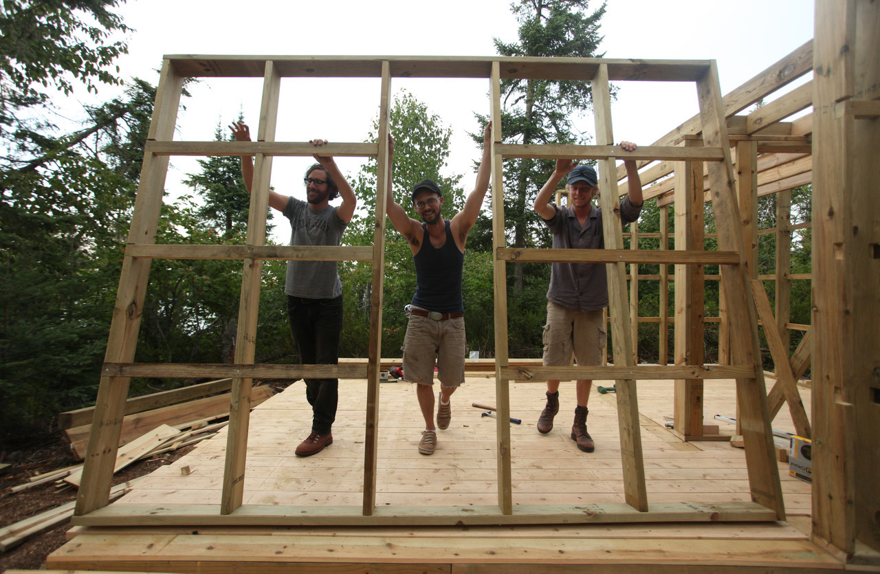
Will Holman is a designer based in Chicago who was one of the three winners in our architecture competition last year. He arrived in the Keweenaw in early August with a bag of tools and a willing spirit and spent close to a week on the island. His intention was to get a sense of the location as a basis for future collaboration. This he accomplished. Below are some of his experiences in his own words as well as photos of the frame-up of our sauna, which he helped design and build.
+ Rabbit Island - by Will Holman
Besides architecture Will works as an assistant to artist Theaster Gates and designs furniture using found and recycled objects. He is also collaborating with us on the fabrication of an island medical kit. The perfect island medical kit–one that has everything you need and nothing you don’t.
More by Will:
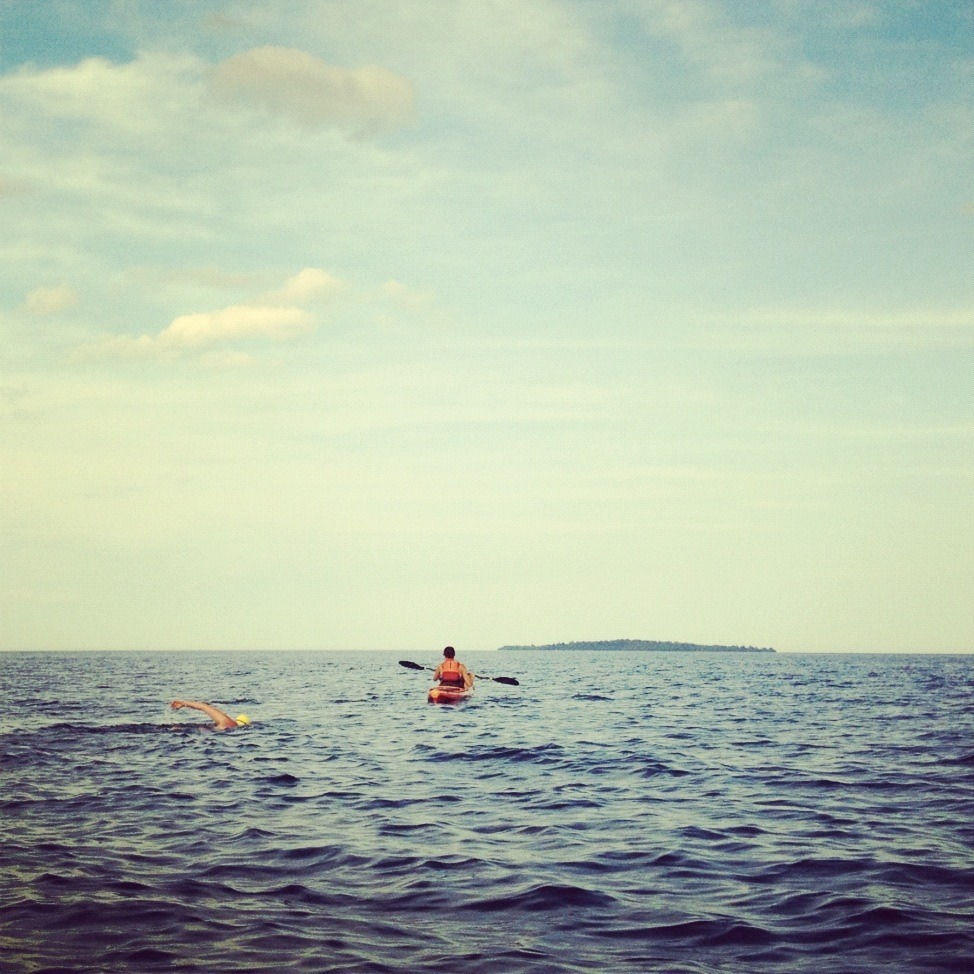
The first person to swim to Rabbit Island
On July 29th, 2012, Sara Maynard swam to the island from the Hannula’s pier in Rabbit Bay. The crossing took one hour and fifty one minutes–A record! The lake was calm that day and the afternoon sky started out sunny and became slightly overcast as she neared the rocky northwestern shore of the island. She touched a foot down in waist deep water and was greeted with howls as she climbed out of the lake to a waiting bonfire.
At the time we had talked about inviting a reporter from our local newspaper, the Daily Mining Gazette, to cover the event but busy days came and went in the preceding weeks and Sara pulled the trigger on a whim amidst a window of promising weather. Regardless, it was the kind of thing where news was made in a small town and we find ourselves still thinking about Sara vs. the Lake in terms of newsprint and smudgy photographs. Grandkids will definitely hear about this one.
Sara had this to say about the experience:
Being on the island allowed me to jump in and swim at any time, for as long as I wanted, without worrying about things like sharks or seals which are always on one’s mind where I train in San Francisco Bay. Also absent was the constant stream of motors zipping around which happens on most inland lakes.
Another thing was the mental component of long distance swimming in the wide open lake. Its one thing to be a competitive pool swimmer where you are racing for a few seconds or minutes, but when you start to get into distance you enter a different mindset. While the island crossing was one of the longest I have done thus far, the actual distance in the water wasn’t something I was terribly concerned with physically. What I was focusing on during training swims around the island and finally during the crossing was what to do when all you hear is water, or silence, for hours. Swims around the island were great and then having the support kayak and dinghy to guide me across the bay was amazing (not to mention the surprise boat visit from you guys). Being removed from the noise of the city for an extended period beforehand also prepared me to be in my own head and with my own thoughts.
So what did I actually do during the 1:51 that it took me to swim close to 4 miles? I have to admit (sadly!) that that silly song was stuck in my head for the beginning of the swim (“So call me, maybe?”). This dissipated, thankfully, and I found silence and the rhythm of swimming. I felt moments of complete awe of where I was (a lake with a fjord!), of the fact that I was spending three weeks on an island in Lake Superior, and that I still had so much ahead of me. I was overwhelmed with feeling completely fortunate to have had this opportunity. Then, when I felt like I had thought a lot about all that, I started counting to 100, until I got to 1000. And then counted some more!
Read more about Sara’s experiences cooking, camping, sauna building, trips to town and view more of her photos on her blog here and here.
p.s. Her trip to the island was sponsored by the Kickstarter community. Thanks y'all.